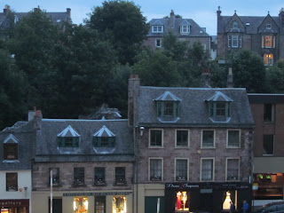
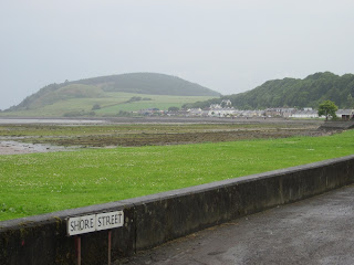
While we had a very nice sense of achievement in finally completing the 'end to end' journey, the arrival at John O'Groats was a bit of an anti-climax - there's not much there apart from a couple of cafes and tourist outlets, as well as the closed multi-coloured hotel. The landscape is unremarkable, unlike that at Duncansby Head 3 km away, which is the true northeasterly point on the British mainland (more on our visit there later).
Still, we really enjoyed the day's ride to John O'Groats and then on to Wick about 30k south. We first rode out to Dunnet Head, the most northerly point of mainland Britain, hoping to see the famous cliffs there. Unfortunately there was a thick sea mist so we couldn't see much, though we did get a good idea of the views from areas where the mist had lifted a few kilometres before and after we reached the headland.
We saw some highland cattle along the way:
Then we visited Jamie at the small Highland Seal Hospital in the village of Scarfesferry. Jamie is an ex-pat Australian and is a keen cyclist. He invited us to stop in for a cup of coffee after seeing a reference to our trip on the CTC forum. He looks after orphaned and/or injured young seals, and currentlly has 4 baby seals in his care which live in small ponds of fresh water in the hospital.
We watched while Jamie fed the seals and also listened while he chatted with a vet who visited to check on the health of one of them. It was fascinating to see the seals close up, to learn about them and to see first hand the great work that Jamie is doing to ensue the survival of those who come to the attention of the small facility run by marine animal enthusiasts.
After leaving Jamie we stopped for a late lunch at the nearby Castle of Mey, which was the late Queen Mother's summer residence. A visitor's centre was established in 2007 in her memory, enabling vistors to tour the castle and grounds. Unfortunately we didn't have time to go inside but it was nice to at least see the castle.
After leaving Jamie we stopped for a late lunch at the nearby Castle of Mey, which was the late Queen Mother's summer residence. A visitor's centre was established in 2007 in her memory, enabling vistors to tour the castle and grounds. Unfortunately we didn't have time to go inside but it was nice to at least see the castle.
Then it was off to John O'Groats in the rain, though it had just about stopped by the time we reached there. We saw Dunnett head from a distance after the fog had lifted:
As noted further below, our route following backroads and Sustrans routes had effectively been about 1850km compared with the most direct route of about 1400km following A roads. We spent 23 days riding and had 3 days off to do some sightseeing.
While at John O'Groats we chatted with two other cyclists (& their support vehicle driver) from Reading near London. They had taken the most direct route and completed the ride in 9 days, averaging about 160km per day (see further below for information on 'end to end' records).
Whle we admired their athleticism, we much prefer enjoying the scenery in the countryside by taking backroads and traffic-free trails rather than busy roads. Still, they were justifiably pleased with their achievement and had raised a significant sum for charity.
We're glad we are cycletourists and didn't have to rush our journey. Greg has also done lots of challenging audax 'fast touring' rides, including twice completing the 1200km 'Paris-Brest-Paris' event within the 90 hour time limit.
After John O'Groats we rode the 3km to Duncansby Head, which is actually the most northeastery point in mainland Britain and has some spectacular scenery. There are sea stacks similar to the 12 apostles off the Victorian coast, as well as two huge rock crevasses.
Then we rode the 27km to our B&B in Wick, . We celebrated by having dinner and a few drinks at a nice pub and then enjoying the music of the live band (who played many songs we recognised). [Saturday 9/7: distance 87 km; climbing: 711 m]
We spent Sunday in Wick, resting, walking around the town and catching up on our washing. On Monday, we caught a train to Inverness and today (Tuesday) we're taking a long train journey to Kings Lynn to visit some friends (Peter & Judith). A few days later we'll visit more friends in Braintree, Essex (Norma & Alan), before returning to London late on Friday until we fly home on 22 July.
Statistics
Here are some statistics for our trip (including the sections totalling about 50km from Penzance to Lands End at the start and from John O'Groats to Wick at the end):
· total days of riding: 23 (+ 3 days off);
· total distance: 1909km, at an average of 82km per day (the total is about 450km more than the shortest distance using mainly A roads, about 1400km, taking into account the extra bits that we rode at either end);
· total climbing: 18,674m, about 810m per day;
· total punctures: one on Toni's bike at Bettyhill (+ one gashed tyre on Greg's bike at Coleford in the Wye Valley - replaced with one of the two folding tyres we were carrying as spares, since our bikes have different sized wheels);
· weather: we had lots of great weather, particularly in the north, with probably only about two days of rain in total (mainly drizzle & showers) during the 23 days we rode.
End to End records
Further to the comments above about the riders who did a relatively quick time, it's worth noting that the record for cycling from Land's End to John O' Groats is held by UK time trial specialist Andy Wilkinson, who completed the journey in 41 hours, 4 minutes and 22 seconds on a Windcheetah recumbent in 1992 (needless to say, as part of a ride with vehicle and other support). The record for rider on a conventional (ie, upright) bicycle is 44 hours, 4 minutes and 20 seconds, set by another noted UK time trialler Gethin Butler in 2001 on a supported ride.
The Australian Sir Hubert Opperman once held the 'end to end' record, setting a time of 54 hours and 33 minute in 1934.
Garmin data issues
As mentioned in one of our early posts, we were hoping to post maps and elevation profiles of each day's stage downloaded from our Garmin GPS computers. But for reasons that remain unclear, we were unable to upload to the Garmin Connect site using our new netbook computer even though we can do so on our PCs at home. This is the error message we get, even after updating to the latest software on the devices and on Garmin Connect:
"UnsupportedDataTypeException: Your device is not supported by this application"We enquired on the Garmin forum about possible solutions. It was suggested that we either upload the data manually or try a different internet browser like Firefox, but limited internet access meant that we did't get the time to explore these suggestions.
Anyway, after we get back to Canberra on 24 July we will upload the data and post the maps & elevation profiles.
Many thanks for following the progress of our 'end to end' ride !!
Greg & Toni


